
LODGING + LOCAL BETA
Flash Foxy mini fest • red river gorge • May 16-18, 2025
The Flash Foxy Climbing Festival will take place in and around the Red River Gorge, located in Southeastern Kentucky. The Red is located within the traditional ancestral homeland of the Cherokee, Shawnee, and many other Nations. Learn more about the Indigenous Peoples throughout the region with the Urban Native Collective.
Getting Here
Iconic Rock... With Southern Flair
Referred to commonly as “The Red,” welcome to one of the South East’s premiere single-pitch sport climbing destinations. The Red River Gorge Geological Area, including Daniel Boone National Forest, is tucked in the hollers of Southeastern Kentucky, known for its grand arches and breathtaking stone amphitheaters.
Ride Sharing + Lodging
We have created a Google Sheet where registered participants can coordinate carpools, ride shares and travel plans with one another. Registered participants will receive a link to the spreadsheet with their ticket confirmation (it’s in the linktree - scroll down!).
Nearest Cities? Closes Airports?
The closest airport is in Lexington, KY, approximately 1 hour away.
The most common airports to fly into are Muhammad Ali International Airport (Louisville) and Cincinnati/Northern Kentucky International Airport (Cincinnati). You’d have to rent a car or carpool from these places. It’s about a 1.5-2 hours drive to the Red.
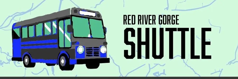
Need a Ride?
Book a ride with The Red River Gorge Shuttle, offering transport to/from Lago Linda Hideaway specifically for Mini Fest attendees!
Stay with us!
*Flash Foxy is not responsible for participant lodging. Flash Foxy is not able to assist with booking.

staying @ Lago Linda hideaway
Want our recommendation? Set up camp at Lago Linda Hideaway and you can be first to breakfast + first to bed even if you stay ‘til the end of programming! Lago Linda Hideaway is our festival basecamp and the majority of our programming will take place here.
Lago Linda Hideaway has lots of open space for tent camping, sites for RV camping, and cabin rentals available for those who would like something less primitive. Book ahead of time on their website!
Pricing starts at $10/night per person for tent camping. Showers, bathrooms, and potable water are available. They also have electricity, WiFi, and a café where you can get a classic, home-cooked meal. In your free time, check out one of the many hiking trails, take a dip in the lake, or try and catch a fish, all on site.
Learn more about the Lago Linda Hideaway!
Fill out their waiver - required for anyone staying or using services on the property!
Prefer Privacy?
*Flash Foxy is not responsible for participant lodging. Flash Foxy is not able to assist with booking.
CAbins
The Red is not in short supply of comfy and picturesque spots for you to stay! From classic cabin style builds to tree houses, you can certainly find something to fit a group of any size!


CAMPING
For those of you who like dispersed camping or want to stay at a different campsite, there’s a few other options within the Red.
The most well-known and popular campground is at Miguel’s Pizza and Gear Shop for $3.50/night per person. Miguel’s has bathroom facilities, showers, laundry, and indoor spaces available for campers to use.
Other camping spots are Daniel Boone Coffee Shop for $3/night per person or Land of the Arches for $10/night per person.
(If you remember your paddles, you can catch a round of pickleball in Land of the Arches’s amphitheater).
If off-grid, dispersed camping is more your style, there are spots throughout Daniel Boone National Forest where you can pitch your tent. Permits are $5/day or $7 for 3 days and can be purchased locally at Daniel Boone Coffee Shop or the gas station. Some parking areas have pit toilets while others don’t have facilities. Tunnel Ridge Road is one of the more popular places to find dispersed camping sites.
Camping is not permitted on RRGCC properties or other privately-owned climbing properties.
hotels + airbnbs
Airbnbs, hotels, and motels are available throughout the area.
LOCAL BETA
A few of our fav local businesses and hangout spots! Check them out while you’re in town!
Food + Coffee
Daniel Boone Coffee Shop - Stop in for a baked good or last-minute souvenir.
Miguel’s Pizza - A staple of the Red, pop an Ale 8 with your pizza after a long day of climbing
Red River Rockhouse - Burgers, Burritos, Beer & More
Redpoint BBQ - Some classic southern BBQ. Save room for dessert!
Hop’s Fork - Farm-to-table restaurant with beers and cocktails
La Cabaña Mexican Restaurant - Mexican food
Skybridge Station - Classic American food
The Brick - Coffee and ice cream
Toad’s Barn & Grill - Comfort food, a full bar, regular live music
Kel’s Patriot Pizza - Breakfast-to-dinner joint offering pizza, calzones, and other American eats in a casual setting
Kroger - Located in Stanton; the exit before Slade! Your standard grocery store
Jack’s IGA Supermarket - Located in Beattyville; your standard grocery store. Items can sometimes be pricey here
Dollar Tree - Locations in Campton and Beattyville; you can get your essentials here
Note: Lee County (where Lago Linda is located) is a dry county. Alcohol will not be sold or distributed at the festival. Mocktails and Ale 8s will be available.
SHOPPING
Miguel’s Gear Shop - Gear shop!
Daniel Boone Coffee Shop - Souvenirs, bourbon, some grocery essentials
The Brick - Grab some beautiful pottery by Turtle Farm Pottery
Activities
For when you need a break from climbing, or for that non-climber who came with you <3
Red River Gorge Ziplines - Zipline through the trees
Thrillsville Adventure Mini Golf - For those who are just putting around
The Gorge Underground - Kayaking in light up kayaks
Jump Rock - The local swimming hole featuring a big rock to jump off of!
Natural Bridge Hike - A treasure of the Red, come see this beautiful, natural arch! Accessibility options available.
RRG Off Roading - Off roading and UTV Tours
Kentucky Reptile Zoo - See many types of venomous snakes from around the world, watch a live venom extraction, or take a breather with our turtles!
Via Ferrata - Get a taste of Red River climbing even if you’re not a “climber”
Ale 8 Factory Tour - Free tours at the Winchester, KY factory
Red RiverFest - Celebrate the Wild & Scenic Red River with fun water and community activities
The Red is in no short supply of amazing hiking trails, views, and places to canoe and kayak!
Climbing Areas

Make sure to fill out your waivers!

-
Google Maps: Motherlode Parking Lot
Bald Rock Recreational Preserve (BRRP) is owned by the Red River Gorge Climbers’ Coalition and home to the Red’s iconic Motherlode. This area also hosts other popular areas like the Chocolate Factory and Hazel Hollow. You’ll find a host of climbs ranging from 5.6 to 5.14d here.
Approach + Trail Surface: Trails vary based on destination, ranging from short and flat to uneven. Trails between climbing areas are mixed terrain including exposed rocks, loose sand/dirt, and mud. Please use Mountain Project or a guidebook to gauge the trail to your specific destination.
Directions: From Lago Linda, turn right onto KY-52 E. Continue for 2.4mi and turn left onto HWY 498. After 1 mile turn left onto Bald Rock Fork Rd, which will be a gravel road on your left. From KY-11, turn right onto Hwy 498. After 1mi, you can take a slight right toward Hopewell Church or continue on Hwy 498, round a corner, and turn right onto Bald Rock Fork Rd (gravel road).
All cars will enter the area via a steep hill. There are three parking lots at the base of the Motherlode hill. There is a top lot on the left side before you enter the steep hill, recommended for 2WD cars. -
Google Maps: Motherlode Parking Lot
Pendergrass-Murray Recreational Preserve (Motherlode entrance) is owned by the Red River Gorge Climbers’ Coalition and home to some of the Red’s most popular areas like Drive-By, The Gallery, and Purgatory. You’ll find a host of climbs ranging from 5.6 to 5.14d here.
Approach + Trail Surface: Trails vary based on destination, ranging from short and flat to uneven. Trails between climbing areas are mixed terrain including exposed rocks, loose sand/dirt, and mud. Please use Mountain Project or a guidebook to gauge the trail to your specific destination.
Directions: From Lago Linda, turn right onto KY-52 E. Continue for 2.4mi and turn left onto HWY 498. After 1 mile turn left onto Bald Rock Fork Rd, which will be a gravel road on your left. From KY-11, turn right onto Hwy 498. After 1mi, you can take a slight right toward Hopewell Church or continue on Hwy 498, round a corner, and turn right onto Bald Rock Fork Rd (gravel road).
There are multiple parking areas depending on which crag you are going to. All cars will enter the area via a steep hill. Once at the base of hill, continue down the road to the parking lot for your crag. There is a top lot on the left side before you enter the steep hill, recommended for 2WD cars.Do not block oil machinery.
Parking lots:
Flat Holler Parking Lot Crags: Velo, Throwback, The Lumber Yard, The Getaway, The Shipyard
Sore Heel Hollow Parking Lot Crags: Curbside, The Gallery, Left Field, Volunteer Wall, The Playground, Bronaugh, The Mega Cave, North 40, Purgatory, Courtesy, Rival, Shady Grove, The Shire, What About Bob
Drive-By Parking Lot Crags: Drive-By, Chica Bonita, Bob Marley
Note: Sore Heel Parking Lot is only recommended for 4WD/AWD cars with substantial clearance. There is an access trail off of the main road to hike back to these crags. -
Google Maps: Far Side Parking Lot
Pendergrass-Murray Recreational Preserve (Coal Bank entrance) is owned by the Red River Gorge Climbers’ Coalition and home to some of the Red’s most popular areas like Darkside, Solar Collector, and Gold Coast. You’ll find a host of climbs ranging from 5.6 to 5.14d here. Gold Coast also has some great entry-level trad for you crack climbers.
Approach + Trail Surface: Trails vary based on destination, ranging from short and flat to uneven. Trails between climbing areas are mixed terrain including exposed rocks, loose sand/dirt, and mud. Please use Mountain Project or a guidebook to gauge the trail to your specific destination.
Directions: From Lago Linda, get onto KY-11 and head North toward Mountain Parkway. Continue for 5.4mi. Once you pass the Marathon gas station, prepare to turn left in about a mile onto Hwy 1036 toward Peaceful Valley Resort. This road will change from pavement to gravel. Continue on this road for approx 5mi. When you see a black tank on the left side of the road, turn right onto the next gravel road.
It is recommended to approach via Fixer Rd, not Cave Fork via Ashland Camp Rd. There is a central parking area for all crags. 4WD/AWD highly recommended for access.Do not block oil machinery.
-
Google Maps: Miller Fork Recreational Preserve
Miller Fork Recreational Preserve (MFRP) is owned by the Red River Gorge Climbers’ Coalition and home to popular areas like the Infirmary, Fruit Wall, and Camelot.
Approach + Trail Surface: Trails vary based on destination. Trails between climbing areas are mixed terrain including exposed rocks, loose sand/dirt, and mud. Please use Mountain Project or a guidebook to gauge the trail to your specific destination.
Directions: 4WD/AWD highly recommended for access. River crossing required if approaching from Beattyville and navigated via Holly Rd.
From Lago Linda, get onto KY-11 N towards Mountain Parkway. Continue for approx 5mi and turn right onto Shoemaker Rd. Continue on Shoemaker Rd for 3.5mi. You’ll pass a house with a lot of equipment in the yard, a 35mph speed limit sign, and possibly pigs (beware, they’re free roaming). Be prepared to take the middle driveway once you round the corner; the descent is steep at first.Do not block oil machinery. Please do not park on Shoemaker Rd.
-
Google Maps: Muir Valley Nature Preserve
Muir Valley Nature Preserve is operated by the Friends of Muir Valley and hosts the highest concentration of climbs in the 5.2-5.10a range. Climbing access to this area costs $15 per car.
Approach + Trail Surface: Trails vary based on destination. Trails between climbing areas are mixed terrain including exposed rocks, loose sand/dirt, and mud. The North trail includes a significantly steep wood staircase. Please use Mountain Project or a guidebook to gauge the trail to your specific destination.
Directions: From Lago Linda, get onto KY-11 and drive toward Mountain Parkway for 5.8mi. Take a slight right onto KY-715. Continue for 2.6mi then take a right onto Big Andy Ridge Rd (JCT 2016). After .8mi take a left onto Fincastle Rd.
This climbing area is access-friendly to 2WD vehicles.
-
Google Maps: Muir Valley Nature Preserve
Graining Fork Nature Preserve (Roadside) is a privately owned and operated crag. Permits are required for access and must be requested in advance. Popular routes include Roadside Attraction, Return of Chris Snyder, and Ro Shampo.
Approach + Trail Surface: Park in the gravel lot shared with Hop’s Fork Restaurant and cross the road. Follow the short trail to the cliffline.
Directions: From Lago Linda, get onto KY-11N and drive toward Mountain Parkway. Park in the lot shared with Hop’s Fork.
This climbing area is access-friendly to 2WD vehicles.
-
Google Maps: Ash Branch Climbing
Ash Branch is a newly-developed, privately-owned crag near Muir Valley. This area gets morning sun to full shade. Routes are new, so expect some choss. Helmets are recommended.
Approach + Trail Surface: From the parking area, find the green rules sign and hike downhill on the wide gravel path. Cross the creek and head uphill, turning left at the arrow. Trail reaches the cliff to the right of Humanoid. Go left for Humanoid- routes are still listed left to right.
Directions: From Lago Linda, get onto KY-11 and drive toward Mountain Parkway for 5.8mi. Take a slight right onto KY-715. Continue for 2.6mi then take a right onto Big Andy Ridge Rd (JCT 2016). After .8mi take a left onto Fincastle Rd. Look for a gravel drive on the right with a wooden sign that says ‘Ash Branch Climbing’ approx .2mi after turning onto Fincastle Rd. Descend the steep hill from there, taking a hard left at the bottom to find parking.
Do not climb tagged routes. These routes are undergoing cleaning, not complete, or not open to the public. -
Google Maps:
Nada Tunnel Access
Sky Bridge Rd AccessThe Northern RRG hosts the majority of the Red’s trad climbing, but also some classic sport. This is where you’ll also find the Red’s first classified rock climb, Caver’s Route, and the uber classic Bedtime for Bonzo 2-pitch romp. Climbing is within the Daniel Boone National Forest and managed by the US Forest Service.
Approach + Trail Surface: Trails vary based on destination. Trails between climbing areas are mixed terrain including exposed rocks, loose sand/dirt, and mud. Please use Mountain Project or a guidebook to gauge the trail to your specific destination.
Directions: There are two ways to enter the DBNF Scenic Loop which is the main access road for the majority of crags in the North. From Lago Linda, get onto KY-11 and drive toward Mountain Parkway. If you are entering via Nada Tunnel, pass under Mountain parkway and turn left onto KY-15N. After 2.2mi, turn right onto KY-77N. Note: Nada Tunnel can only accommodate cars in one direction at a time. You may have to wait as cars pass through. To enter via Skybridge Rd, take a slight right onto KY-715 as if you are going to Muir Valley. Continue for 18mi and take a right onto Sky Bridge Rd.
Parking spots are pull-offs from the main road, paved and 2WD friendly.

-
All primary festival activities (opening party, workshops, board games, panels, dinner) will be held at wheelchair accessible venues and will have accessible bathrooms. The Fireside Chat will take place adjacent to the Pavilion, in a flat grassy area.
ASL interpreters can be coordinated upon request. Please email events@flashfoxy.com to discuss your needs.
Approaches differ by climbing area. Details about approaches can be found below, or can be found on Mountain Project.
Have an accessibility concern? Reach out to events@flashfoxy.com and we’ll see how we can help!
We are always working to make the Flash Foxy Climbing Festival a more inclusive and welcoming space, please let us know what we can do to make our event more accessible for you. Unfortunately, we are not always able to arrange accommodations, but we will do our best and will provide honest answers about the our event spaces, staff capabilities and the activities that take place at our festivals. Thank you for learning and growing with us!
-
Google Maps: Lago Linda Hideaway
About the venue: All of our programming, with the exception of clinics and our stewardship projects, will take place at Lago Linda Hideaway. Workshops, demos, board games, and Sunday morning’s community conversation will take place under their big pavilion. Field games and Saturday’s Fireside Chat (Panel) will take place in the grassy open space next to the pavilion. The Shake-Out Lounge is located next to the Pavilion and is a comfortable indoor space with outlets, free WiFi, and tables. NOTE: The Shake-Out Lounge will be open to other campers at Lago Linda Hideaway during the festival.
Bathhouses are located at the front of the property near the Café and by the Bertie Branch primitive camping area.
The roads through Lago Linda are gravel, and these serve as major pathways to and from. The campground where we will be staging is the flattest location and is a combination of grass and gravel. The terrain still undulates but not nearly as much as the other surroundings. Cars can access almost any single nook and corner of the camp ground.
Directions: Take the Exit 33 toward Slade. Turn right onto KY-11 and continue for 14 miles. Turn right into Hwy 498, continue for 2.5 miles. Turn right onto KY-52 W and continue for 2.4 miles. Turn left onto KY-399 S. Follow signs to Lago Linda. There is a large parking lot with marked accessible parking spaces available.